Categories
Categories
- $1 Items
- Digitally Archived Documents
- Downloadable Maps
- DVD's and Video's
- Geology and Ore Deposits
- History
- Jewelry Gems Lapidary
- Lode Mining
- Metal Detecting
- Mineral Processing & Metallurgy
- Mining & Geology
- New
- No Category
- Placer Mining
- Prospecting and Exploration
- Publications by Country
- Publications By State
- Rare and Out of Print
- Treasure Hunting
- Home
- Publications By State
- Preliminary Report Mining Districts Idaho Gold Silver
Preliminary Report Mining Districts Idaho Gold Silver
$7.95
Product Description
Rare Publications on Ebook
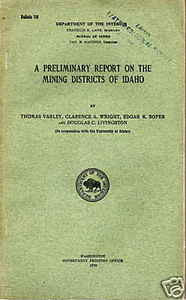
A Preliminary Report on the Mining Districts of Idaho
Bulletin 166 - Bureau of Mines
143 Pages
Contents:
-
Introduction
-
Acknowledgments
-
Ore treatment problems
-
Brief historical review of mining in Idaho
-
Early discoveries of gold
-
Early political history of Idaho
-
Discovery of Couer D'Alene region
-
New activities
-
Mining districts of Idaho and output
-
Extent of mineralization
-
Idaho mine output in 1917
-
The northern counties
-
Boundary County
-
Priest Lake district
-
Moyie-Yaak district
-
Bonner County
-
Lake View district
-
Blacktail district
-
Clark Fork district
-
Hope district
-
Kootenai County
-
Benewah County
-
Bibliography
-
Shoshone County
-
Districts in the Coeur D'Alene region
-
Beaver district
-
Evolution district
-
Hunter (Mullan) district
-
Lelande (Burke) district
-
Murray (Eagle) district
-
Pine Creek district
-
Placer Center (Wallace) district
-
Summit district
-
Yreka (Kellogg-Wardner) district
-
Other districts in Shoshone County
-
Bald Mountain (Monitor) district
-
Black Prince (East Coeur D'Alene) district
-
Shoshone (Coeur D'Alene) district
-
Slate Creek district
-
Sliderock Mountain district
-
St. Joe district
-
Milling practice in the Coeur D'Alene region
-
Hand sorting
-
Coarse crushing
-
Coarse screening
-
Jigging
-
Treatment of fine material
-
Fine crushing
-
Table concentration
-
Flotation
-
Mill products
-
Bibliography of Shoshone County
-
Latah, Clearwater, Nez Perce, and Lewis Counties
-
Latah County
-
Blackfoot or Gold Hill district
-
The Hoodoo district
-
Troy district
-
Moscow Mountain and Thatuna Hills
-
Robinson or Mica Mountain district
-
Ruby Creek district
-
Clearwater County
-
Nez Perce and Lewis Counties
-
Bibliography
-
Idaho and Valley Counties
-
Idaho County
-
Camp Howard district
-
Cotton Buttes district
-
Crook's Corral district
-
Divide Creek district
-
Dewey (Harpster) district
-
Dixie district
-
Elk City district
-
Florence district
-
Marshall Lake district
-
Newsome Creek district
-
Ore Grande district
-
Rapid River district
-
Robbins (Buffalo Hump) district
-
Salmon River (Simpson) district
-
Warren district
-
Valley County
-
Big Creek district
-
Profile district
-
Ramy Ridge district
-
Thunder Mountain district
-
Warm Lake district
-
Yellow Pine district
-
Deposits at Deadwood River
-
Bibliography of Idaho and Valley Counties
-
Adams and Washington Counties
-
Adams County
-
Black Lake (Mountain View) district
-
Seven Devils district
-
Washington County
-
Heath district
-
Hornet Creek (Galena) district
-
Mineral district
-
Meadows district
-
Monroe Creek (Weiser) district
-
Bibliography
-
Ada, Boise, Elmore, Gem, and Owyhee Counties
-
Ada County
-
Black Hornet district (Shaw's Mountain)
-
Boise (McIntyre) district
-
Snake River Placer district
-
Boise County
-
Banner district
-
Centerville district
-
Elkhorn district
-
Gambrinus district
-
Gold Hill, Granite, or Quartsburg district
-
Grimes Pass district
-
Highland Valley district
-
Idaho City district
-
Moore's Creek and Pioneerville district
-
Placerville district
-
Shaw's Mountain district
-
Twin Springs district
-
Elmore County
-
Atlanta (Middle Boise) district
-
Bear Creek (Rocky Bar) district
-
Black Warrior district
-
Dixie district
-
Glenn Ferry district
-
Hardscrabble district
-
Neal district
-
Pine Grove district
-
Owyhee County
-
Carson (War Eagle, Silver City, Florida Mountain) district
-
De Lamar district
-
Castle Creek district
-
Flint district
-
Mammoth district
-
South Mountain district
-
Gem County
-
Pearl (Willow Creek, Gem, Rock Creek) district
-
Squaw Creek or Bodie district
-
Bibliography
-
Blaine, Butte, Camas, Custer, Lemhi, and Fremont Counties
-
Blaine County
-
Antelope district
-
Elkhorn (Ketchum) district
-
Galena district
-
Lava Creek district
-
Muldoon district
-
Rosetta district
-
Sawtooth district
-
Vienna district
-
Warm Springs district
-
Wood River (Hailey) district
-
Butte County
-
Dome district
-
Camas County
-
Camas district
-
Little Smoky district
-
Skeleton Creek district
-
Soldier district
-
Custer County
-
Alder Creek (Mackay) district
-
Bay Horse district
-
East Fork district
-
Hamilton or Clyde district
-
Loon Creek district
-
Yankee Fork district
-
Copper Basin district
-
Boulder district
-
Sheep Mountain district
-
Seafoam and Greyhound districts
-
Description of samples
-
Lemhi County
-
Blackbird district
-
Blue Wing district
-
Carmen Creek district
-
Eldorado district
-
Eureka district
-
Gibbonsville district
-
Gravel Range district
-
Indian Creek district
-
Junction district
-
Kirtley Creek district
-
Mackinaw district
-
McDevitt district
-
Mineral Hill district
-
Nicholia district
-
Parker Mountain district
-
Pratt Creek district
-
Spring Mountain district
-
Texas district
-
Yellow Jacket district
-
Fremont County
-
Skull Canyon district
-
Buck Creek district
-
Bibliography
-
The southeastern counties
-
Bannock County
-
Fort Hall district
-
Soda Springs district
-
Bear Lake County
-
Bear Lake district
-
Bonneville County
-
Mount Pisgah (Caribou Mountain) district
-
Cassia County
-
Stokes (Cannon Creek) district
-
Black Pine district
-
Other districts
-
Madison County
-
Canyon Creek district
-
Teton County
-
Bibliography
-
Preliminary report on the Horseshoe District of the Teton coal basin, Southeastern Idaho
-
Introduction
-
Maps
-
Location
-
Topography
-
Geology
-
Structure
-
Faults
-
Geological age
-
Coal beds
-
Coal bed at Horseshoe mine
-
Coal bed at Bell Gulch drift
-
Brown Bear bed
-
Boise bed
-
General
-
Quality of coal
-
Tonnage
-
Analyses of coals
-
Horseshoe district, Teton coal basin, Southeastern Idaho
-
Bell Gulch bed
-
Brown Bear bed
-
Boise bed
-
Mining
-
History
-
Gases
-
Method of working
-
Longwall system
-
Pillar-and-chutes or pillar-and-breasts
-
Equipment
-
Management
-
Market
-
Freight rates
-
Transportation
-
Conclusion
- Publications on coal and metal mining
* This document was digitally archived by Sylvanite, Inc. and is not to be used for resale or reproduction. Upon Purchase you will recieve a link via email to download your item.


 Loading... Please wait...


